
Geospatial Services from eLogicTech Solutions
eLogicTech integrates Geographic Information Systems (GIS) and cutting-edge technology to provide the most advanced geospatial services. With a team of geospatial data analysts, eLogicTech uses Terrestrial Laser Scanning (TLS), Light Detection and Ranging (LiDAR), and cartography, etc. to assist businesses with accurate geospatial intelligence.
Geospatial data analysis being a specialized skill area, requires a lot of research, data collection, and environmental modeling to infer information for decision-making. Being a leading civil engineering service provider for over 20 years, eLogicTech understands clients' vivid geospatial requirements and have been associated with a vast clientele in agriculture, mining, healthcare, and infrastructure development. To learn more about our geospatial skills and the projects we have worked on, contact us.

Benefits of eLogicTech's
HIGHLY EXPERIENCED TEAM AT YOUR SERVICE
The geospatial experts at eLogicTech have worked on several projects of varied complexity to offer their experience-laced support.
PRECISION GUARANTEED
Making use of the latest tools, software, and infrastructure, eLogicTech makes sure that you receive the accurate data in every portion of the project.
ASSURED DATA SAFETY
GIS involves critical customer identifiable data in the form of addresses and other information which eLogicTech take utmost care to secure.
BEST PRICE AND STRICT ADHERENCE TO TIMELINES
From the pricing standpoint, eLogicTech Solutions promises to give the best possible service experience at the most competitive price.
Geospatial Services Leveraging Advanced Geospatial Technology
Organizations with the requirements pertaining to land administration, land development, agricultural analysis, geo-mapping, etc. can avail eLogicTech's range of geospatial analysis. Our services include the following:
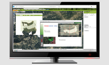
GIS Survey and Consultation
Along with the digital elevation modeling from paper-based blueprints, eLogicTech performs land scanning, plotting, and geo-referencing to provide GIS-based solutions.
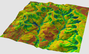
Terrain Modeling
Using LiDAR and photogrammetric techniques, eLogicTech's geospatial specialists create realistic models terrains with factual data on geographic positions and conditions.
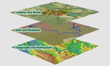
Geo Mapping Service
Catering to a variety of industry verticals, such as retail, food chain, transportation, and telecom, etc. eLogicTech offers integrated geo-mapping services that assist organization build and manage their GIS-based applications.
Photogrammetric Service
eLogicTech makes use of remote sensing and automated image classification to provide planimetric mapping such as high-way corridor mapping which is precise as well as aligned to real images.


Civil Engineering Outsourcing Company
Partner with eLogicTech to Make Use of the Best Geospatial Intelligence
Amidst a lot of geospatial service providers in the market, what sets eLogicTech apart is its wide range of services. Starting from BIM, MEP, Architectural CAD, 3D Visualization, Structural Engineering, and more, eLogicTech provides you a comprehensive consultation around civil/structural/architectural sphere.
So, as a business house, strengthen your service range by partnering with eLogicTech, the most trusted geospatial data analysis experts.
Need Help?
Don't hesitate to contact us for more information about company or service